


Model*
Not include shipping cost.
LINK-PP LPJ1075-1BHNL 100% Cross RTA-110AHQ1A UDE
United States
Carrier
CostDelivery TimeTracking
DHL
$ 21.45 3-7 daysAvailable
Fedex IP
$ 29.58 3-7 daysAvailable
DHL自定义
$ 34.37 3-7 daysAvailable
UPS Express Saver
$ 65.26 3-7 daysAvailable
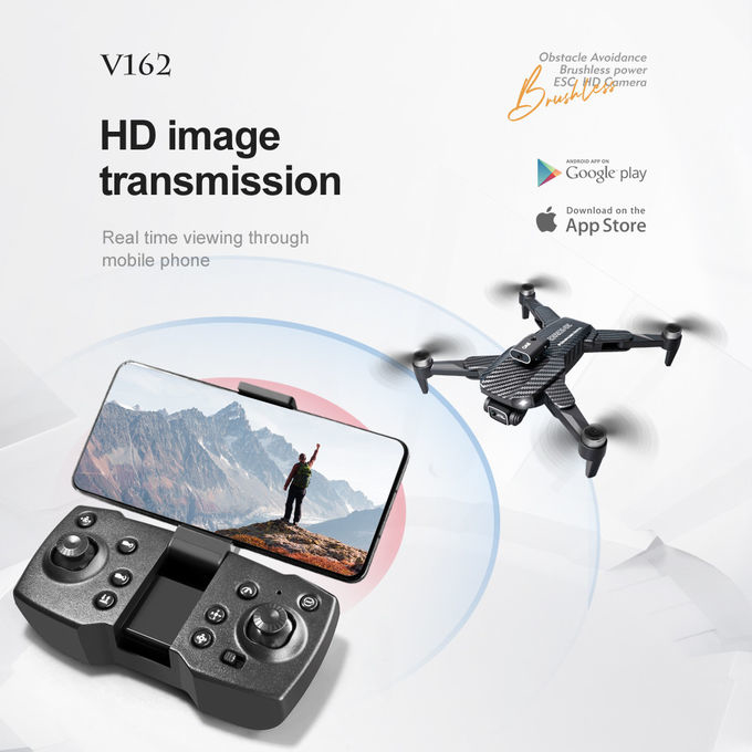
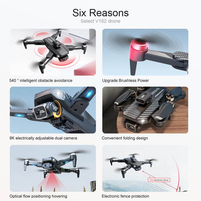
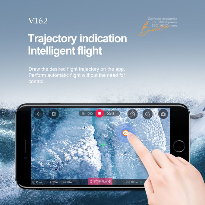
Powerful Aerial Videography Drone 200M High Resolution Camera Drone
Aerial Photography Uav is an advanced aerial surveillance drone and video platform designed for aerial photography, surveillance and aerial video creation. This powerful unmanned aerial vehicle (UAV) has an impressive range with a maximum chart pass distance of 30M, two-axis gimbal, GPS/GLONASS satellite positioning systems and a foldable wheelbase with a 1800 Mah battery for extended flight times. It is an excellent choice for UAV airborne photography and aerial surveillance.
| Satellite Positioning Systems | GPS/GLONASS |
|---|---|
| Remote Control Distance | 200M |
| Battery | 1800 Mah |
| Wheelbase | Foldable |
| Chart Pass Distance | 30M |
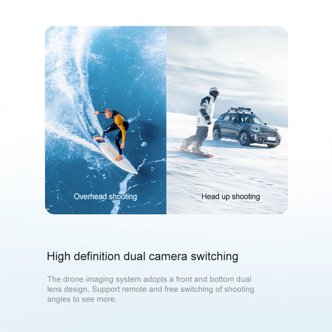
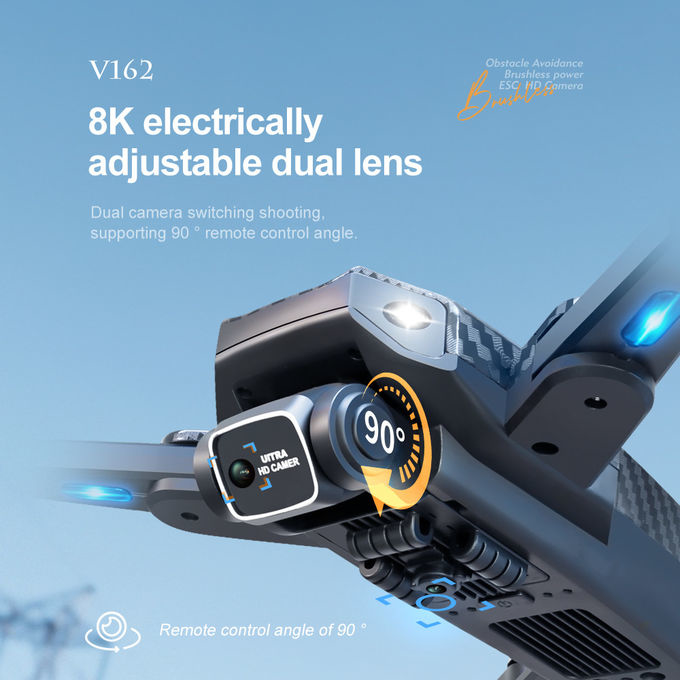
| Gimbal | Two Axis |
Aerial Photography UAV is equipped with a Model Number V162 made in China, with a minimum order quantity of 1 pcs and a negotiable price. It is packaged in standard packages and has a delivery time of 3-7 work days with payment terms of L/C, D/A, D/P, T/T, Western Union. It has a supply ability of 100,000 pcs per month. The Chart Pass Distance is 30M and the Remote Control Distance is 200M. It is powered by a 1800 Mah Battery and has a foldable Wheelbase. It is equipped with GPS/GLONASS Satellite Positioning Systems.
Aerial Photography UAV is ideal for drone photo system, UAV airborne photography and aerial imaging device. It is used by professional photographers, filmmakers, surveyors and other experts. It has a chart pass distance of 30M and a remote control distance of 200M. It is powered by a 1800 Mah battery and has a foldable wheelbase. It is equipped with GPS/GLONASS satellite positioning systems which enables high precision and accuracy. It is also perfect for aerial mapping, surveillance, cinematography, photography and inspections.
Our Aerial Photography UAV offers comprehensive UAV solutions for aerial surveillance and photography. Model V162 is equipped with two axis gimbal and foldable wheelbase for better stability and portability. It has a remote control distance of up to 200M and chart pass distance of 30M. This UAV also has a 1800 Mah battery to power it up.

Foldable Infrastructure Inspection Drone 200m Remote Control

V162 Aerial Photography UAV Foldable Remote Control Camera Drone 200M

200m Infrastructure Inspection Drone Foldable Camera Drone With Obstacle Avoidance
1 Sold

E100 Infrastructure Inspection Drone Remote Control Obstacle Detection Drone

2.4G fixed height Precision Agriculture Drone Remote Control 150m

3 Axis Gimbal Search And Rescue Drone Foldable Maximum Distance 1080P 10km
3 Sold

Two Axis Gimbal Remote Control RC Drone 3000m Remote Control Foldable Drone

Two Axis Gimbal Precision Agriculture UAV Remote Control Precision Farming Drones

Foldable Aerial Photography UAV Aerial Camera Drone With Remote Control

CMOS Sensor Aerial Photography UAV Unmanned Aerial Vehicle Drone

Foldable Precision Agriculture UAV Drones For Crop Monitoring

Intelligent Infrastructure Inspection Drone / 360° Obstacle Avoidance UAV

Light Gray 2.4GHZ Aerial UAV Drone With Camera And Remote Control
1 Sold

ZAi E88 Aerial Photography Drone150 Meters Flight Distance Radio Controlled Drone for Performance
3 Sold

Long Endurance Load Bearing Drone USB Charging 3000M Remote Control

Remote Control Infrastructure Drone / Affordable Obstacle Avoidance Drone
