


Model*
Not include shipping cost.
LINK-PP LPJ1075-1BHNL 100% Cross RTA-110AHQ1A UDE
United States
Carrier
CostDelivery TimeTracking
DHL
$ 21.45 3-7 daysAvailable
Fedex IP
$ 29.58 3-7 daysAvailable
DHL自定义
$ 34.37 3-7 daysAvailable
UPS Express Saver
$ 65.26 3-7 daysAvailable
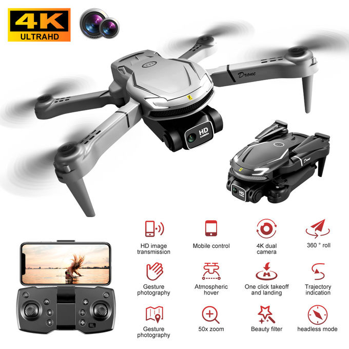
2.4G fixed height Precision Agriculture Drone Remote Control 150m
GPS GLONASS Precision Agriculture Uav 1800 Mah
Specification
| Product model | V88 | Product size | 26*23.5*5.5cm(unfolded size) 12*8*5.5cm(folded size) | ||
| Product name | 2.4G fixed height aerial photography drone | Storage bag package size | 21*6*15cm | ||
| Body color | Black, gray | Storage bag full set weight | 332g | ||
| Body battery | 3.7V 1800 mah lithium battery | Color box package size | 22.2 * 6.7 * 17.5 cm | ||
| Remote control battery | Battery size 3 by 5 (not included) | Color box full set weight | 413g | ||
| Flight time | About 10 minutes | Battery weight | 21g | ||
| Charging time | 60 minutes | Number of boxes | 36pcs | ||
| Remote control distance | 150m | Outer box specifications | Storage bag outer box 66*26.5*50cm color box outer box 46*42.5*55cm | ||
| Figure transmission distance | 30m | Gross net weight of outer box | 15.5/14 kg | ||
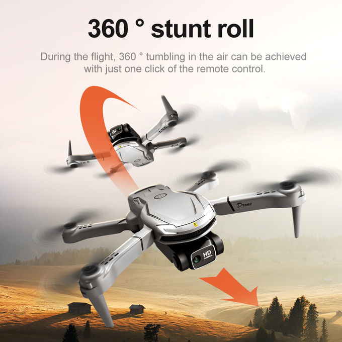
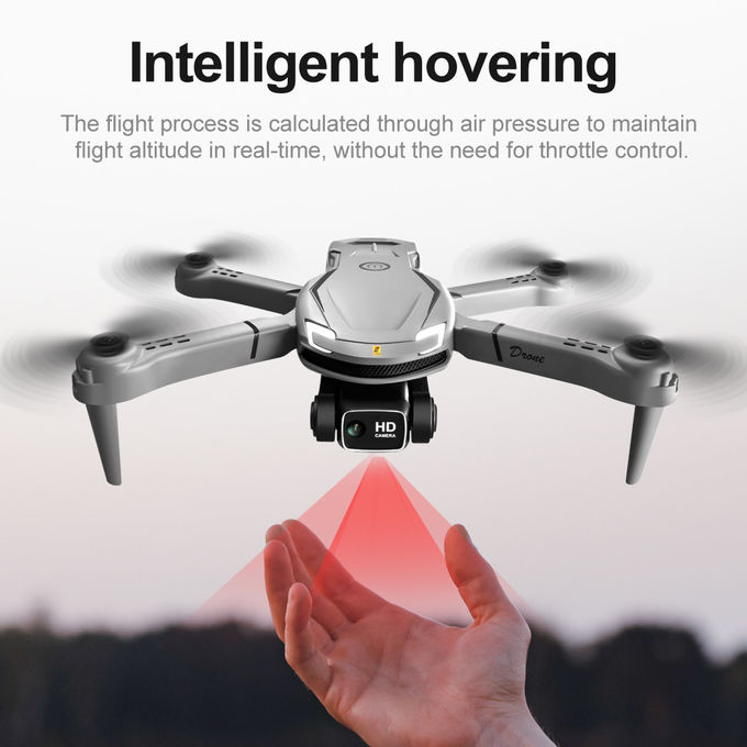
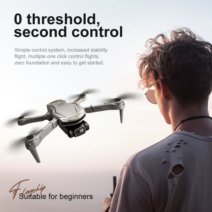
| No camera feature | Fixed height function, aircraft foldable, six-pass band gyroscope; One button take off, one button land, rise and fall, forward and backward, left and right side fly, turn, headless mode, fuselage light/headlight | ||||
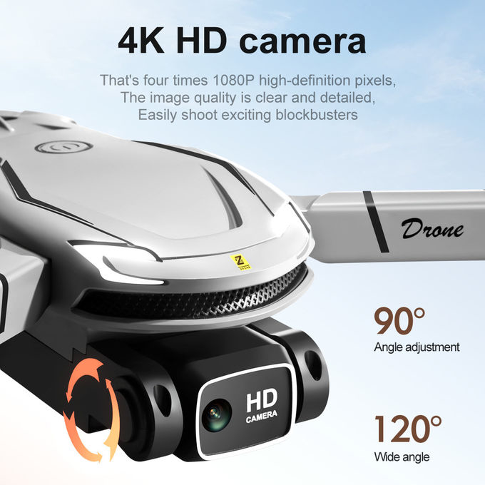
| With camera function | Fixed height function, aircraft foldable, six-pass band gyroscope; One-button take off, one-button land, rise and fall, forward and backward, left and right side flight, steering, headless mode, body light/headlight (with camera can be added: gesture photography, video, headless mode, emergency stop, trajectory flight, gravity sensing, music, 50x zoom, automatic photography) | ||||
| Accessories | Aircraft *1 Remote Transmitter *1 Body battery *1 Spare blade set of USB cables *1 Screwdriver *1 Instruction manual *1 Built-in HD camera *1 WIFI instruction manual *1 | ||||
Description
Precision Agriculture UAVs (Unmanned Aerial Vehicles), also known as drones, are unmanned aircraft equipped with specialized sensors and imaging technologies used for precision agriculture applications. These UAVs are specifically designed to gather data and provide valuable insights for optimizing agricultural practices and improving crop yields
Features
Applications

Foldable Precision Agriculture UAV Drones For Crop Monitoring

Emergency Search Rescue Drone 3 Axis Gimbal 4k Drone With LCD Screen

E100 Infrastructure Inspection Drone Remote Control Obstacle Detection Drone

Foldable Wheelbase Precision Agriculture UAV 150m RC Remote Control Drone

200m Infrastructure Inspection Drone Foldable Camera Drone With Obstacle Avoidance
1 Sold

Two Axis Gimbal Remote Control RC Drone 3000m Remote Control Foldable Drone

CMOS Sensor Aerial Photography UAV Unmanned Aerial Vehicle Drone

Intelligent Infrastructure Inspection Drone / 360° Obstacle Avoidance UAV

3 Axis Gimbal Search And Rescue Drone Foldable Maximum Distance 1080P 10km
3 Sold

ZAi E88 Aerial Photography Drone150 Meters Flight Distance Radio Controlled Drone for Performance
3 Sold

Foldable Infrastructure Inspection Drone 200m Remote Control

E100 Infrastructure Inspection Drone Intelligent Obstacle Avoidance Drone UAV

Remote Control Infrastructure Drone / Affordable Obstacle Avoidance Drone

Long Endurance Load Bearing Drone USB Charging 3000M Remote Control

Foldable Aerial Photography UAV Aerial Camera Drone With Remote Control

Remote Control Aerial Photography UAV Drone With Camera For Photography
