


Not include shipping cost.
LINK-PP LPJ1075-1BHNL 100% Cross RTA-110AHQ1A UDE
United States
Carrier
CostDelivery TimeTracking
DHL
$ 31.97 3-7 daysAvailable
Fedex IP
$ 44.07 3-7 daysAvailable
DHL自定义
$ 51.37 3-7 daysAvailable
UPS Express Saver
$ 94.28 3-7 daysAvailable
5m/s Aerial Remote Sensing Drone With Thermal Imaging Camera
The Remote Sensing Drone is an Autonomous Aerial Vehicle (UAV) that provides remote sensing capabilities. It is equipped with a 3-axis gimbal and a maximum distance of 1080P 10km. The operating temperature range is -5-40℃. The flight control is compatible with Mavlink Protocol Flight Control, and its wheelbase is 600mm, foldable. The Remote Sensing Drone is an Unmanned Aircraft System (UAS) that is designed to provide high-quality remote sensing data and advanced autonomous operations. It is an ideal solution for applications such as mapping, surveying, and aerial photography. The drone is capable of autonomous flight with a high degree of accuracy and stability, making it an ideal remote sensing platform.
| Technical Parameter | Description |
|---|---|
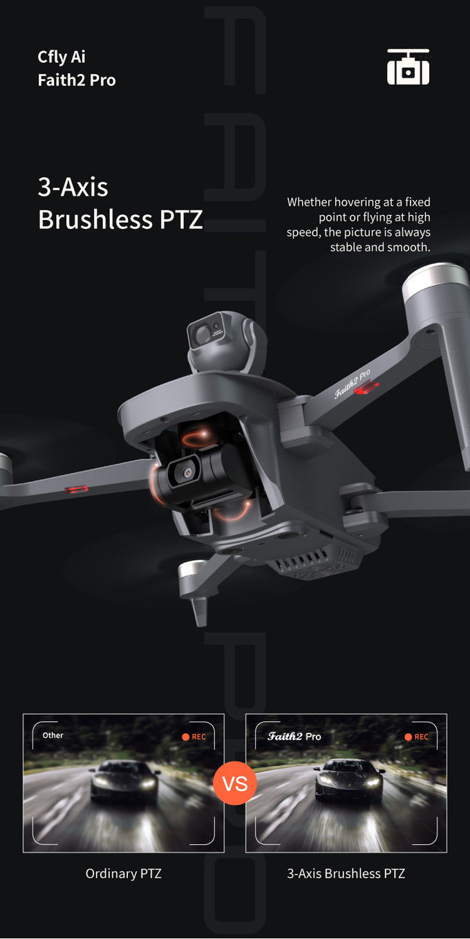
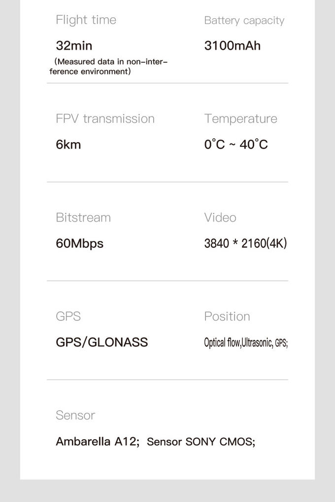
| Gimbal | 3-axis |
| Maximum Distance | 1080P 10km |
| Operating Temperature Range | -5-40℃ |
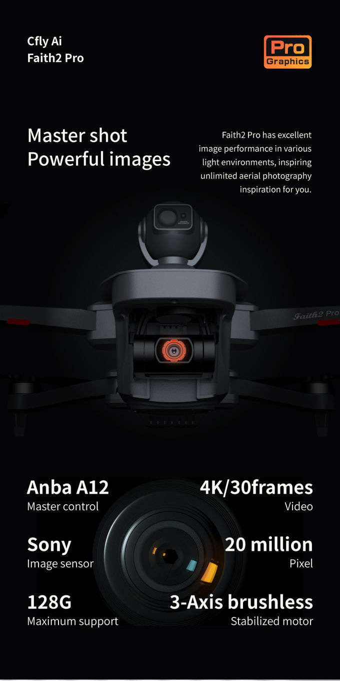
| Photo | JPEG |
| Image Size | 3840*2160 |
| Maximum Ascend Speed | 5m/s |
| Maximum Decsend Speed | 4m/s |
| Flight Time | 40mins(no Load),29mins(full Load) |
| Battery | 3100mAh |
| Max Service Ceiling Above Sea Level | 4000 M |
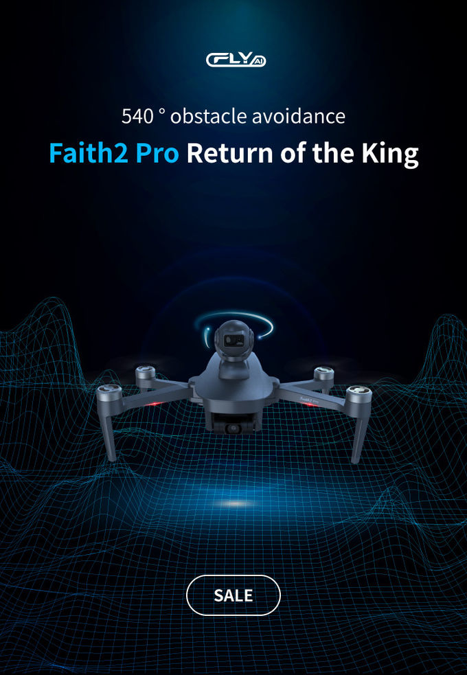
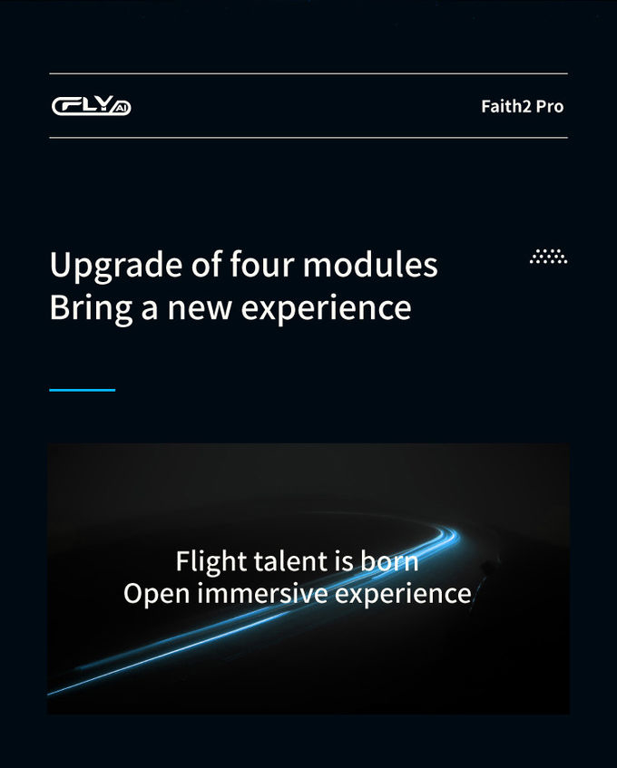
Remote Sensing Drone, with model number Faith 2 Pro, is an Unmanned Aerial Vehicle (UAV) for airborne surveillance and imaging. Originated from China, this drone is available in a minimum order quantity of 1 pcs, with a negotiable price, standard packages and a delivery time of 3-7 work days. Payment terms include L/C, D/A, D/P, T/T, Western Union. The supply ability is 100,000 pcs per month. The drone is equipped with a 3-axis gimbal and Mavlink Protocol Flight Control. The maximum service ceiling above sea level is 4000 m and the image size is 3840*2160. The operating temperature range is -5-40℃.
We offer custom services for Remote Sensing Drone with the following features:
Our Remote Sensing Drone is an Autonomous Aerial System, Autonomous Aerial Vehicle, Unmanned Aerial Vehicle designed to be reliable and flexible for customized applications.
Q1: What is the model number of the Remote Sensing Drone?
A1: The model number of the Remote Sensing Drone is Faith 2 Pro.
Q2: Where is the Remote Sensing Drone made?
A2: The Remote Sensing Drone is made in China.
Q3: What is the minimum order quantity for Remote Sensing Drone?
A3: The minimum order quantity is 1 Pcs.
Q4: What is the price for the Remote Sensing Drone?
A4: The price is Negotiatial.
Q5: What is the delivery time for the Remote Sensing Drone?
A5: The delivery time is 3-7 work days.

High Capacity 5 Km Range Remote Control RC Drone With 3 Axis Gimbal Camera HK-DF816D

4m/S 3D Mapping Drones For Surveying Land 3840*2160 Image Size

Durable Remote Sensing Drone 3 Axis Gimbal Drones For Environmental Monitoring

Faith2 SE Aerial Survey Drone Foldable Remote Control Drone With Camera

3 Axis Gimbal Load Bearing Drone 4m/s Cargo Carrying Drone Foldable

Mapping And Surveying Drones , Professional Drones For Surveying

3 Axis Gimbal Drone High Performance For Fire Rescue Power Patrol HK-DF816D

Long Distance Heavy Lifting Drone Heavy Payload Drone With 29 mins Full Load Flight Time HK-DF816D
3 Axis Gimbal Load Bearing Drone 4m/s Cargo Carrying Drone Foldable

JPEG Photo Remote Sensing Drone 3 Axis Gimbal With Thermal Imaging Technology
2 Sold

Custom Aerial Survey Drone Advanced Aerial Surveillance Drone For Surveying And Mapping

white Custom 3 Axis Gimbal Camera Drone For Construction Industry HK-DF846D

1080p 4k Ultra HD Camera Drone Industrial Drones For Lifting HK-Faith Mini

High Range Aerial Survey Drone 17m/s Foldable 2 Axis Gimbal Drone HK-DF809G

1080P 10km Remote Sensing Drones Agriculture / Crop Monitoring Drone
1 Sold

Precision Agriculture Drone 1080P 10km Environmental Monitoring Drone Remote Sensing
