


Not include shipping cost.
LINK-PP LPJ1075-1BHNL 100% Cross RTA-110AHQ1A UDE
United States
Carrier
CostDelivery TimeTracking
DHL
$ 31.97 3-7 daysAvailable
Fedex IP
$ 44.07 3-7 daysAvailable
DHL自定义
$ 51.37 3-7 daysAvailable
UPS Express Saver
$ 94.28 3-7 daysAvailable
JPEG Photo Remote Sensing Drone 3 Axis Gimbal With Thermal Imaging Technology
The Remote Sensing Drone is an airborne surveillance drone, also known as an Unmanned Aerial Vehicle (UAV). It is designed to capture data and imagery from the sky with its advanced features. Its Max Service Ceiling Above Sea Level is 4000 M, and Flight Time is 40mins(no Load) and 29mins (full Load). It is equipped with GPS/GLONASS satellite positioning systems and a 3-axis gimbal for greater accuracy and stability. It can capture images of up to 3840*2160 size with high quality and detail. The Remote Sensing Drone is a powerful tool that can be used for surveying, mapping, and capturing data and imagery from the sky for a variety of applications.
| Parameter | Value |
|---|---|
| Maximum Ascend Speed | 5m/s |
| Image Size | 3840*2160 |
| Battery | 3100mAh |
| Maximum Decsend Speed | 4m/s |
| Operating Temperature Range | -5-40℃ |
| Maximum Distance | 1080P 10km |
| Gimbal | 3-axis |
| Max Service Ceiling Above Sea Level | 4000 M |
| Wheelbase | 600mm,foldable |
| Flight Time | 40mins(no Load) ,29mins(full Load) |
Remote Sensing Drone, model Faith 2 Pro, is a powerful and autonomous aerial system that provides long range flight and object tracking. It is manufactured in China and provides a maximum distance of 1080P 10km, with a maximum service ceiling above sea level of 4000M. It has a flight time of 40 minutes (no load) and 29 minutes (full load), and an image size of 3840*2160. It is equipped with GPS/GLONASS satellite positioning systems. The minimum order quantity is 1 pc, and the price is negotiable. The delivery time is 3-7 work days, and the payment terms are L/C, D/A, D/P, T/T, Western Union. The supply ability is 100,000 pcs per month, and it is packaged in standard packages.
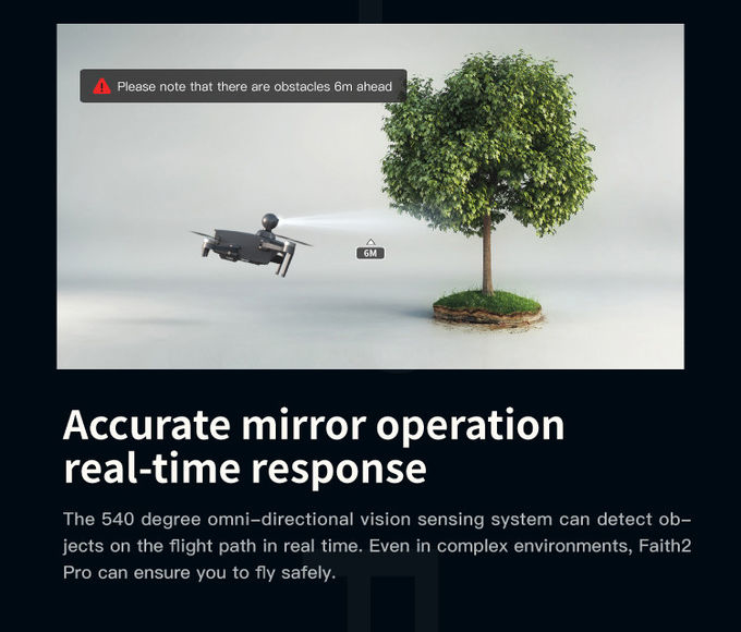
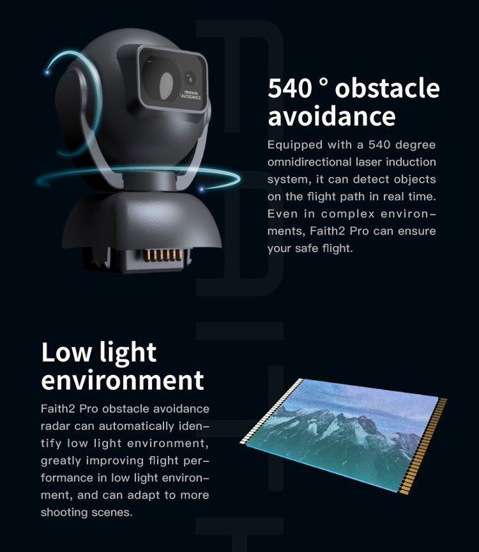
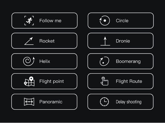
Remote Sensing Drone can be used to conduct geo-mapping, remote sensing, environment monitoring, and object tracking. Its features include long range flight, autonomous systems, robotic aerial systems, and more. Remote sensing drone, model Faith 2 Pro, can be used for a variety of applications, including surveying and mapping, crop health monitoring, and other remote sensing operations.
Customized Service for Remote Sensing Drone - Faith 2 Pro
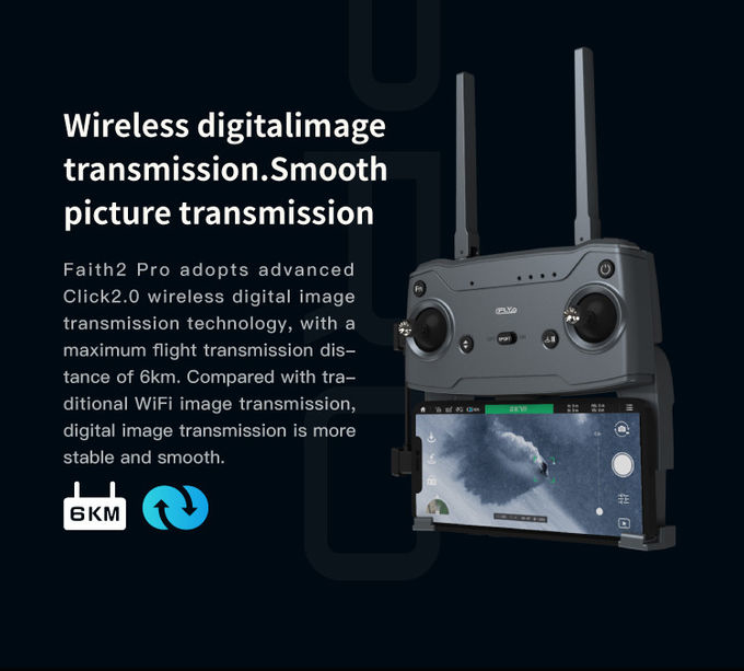
Our remote sensing drone Faith 2 Pro is a robotic aerial system, an unmanned aerial vehicle (UAV) and a remotely piloted aircraft, designed for remote sensing applications. It is equipped with GPS/GLONASS satellite positioning systems, global 4G image transmission, and 1080P 10km maximum distance.
Model Number: Faith 2 Pro
Place of Origin: China
Minimum Order Quantity: 1 Pcs
Price: Negotiatial
Packaging Details: Standard Packages
Delivery Time: 3-7 work days
Payment Terms: L/C, D/A, D/P, T/T, Western Union
Supply Ability: 100,000 pcs per month
Maximum Ascend Speed: 5m/s
Photo: JPEG
Satellite Positioning Systems: GPS/GLONASS
Maximum Distance: 1080P 10km
4G Extended Image Transmission: Global 4G Image Transmission, Unlimited Distance

3 Axis Gimbal Drone High Performance For Fire Rescue Power Patrol HK-DF816D

Aerial Inspection Drone Surveying And Mapping 4m/s Professional Photography Drones

Foldable Aerial Survey Drone Two Axis Gimbal Construction Site Drone Aerial Photogrammetry

Aerial Photogrammetry Drone Foldable 3D Scanning Drone For Topographic Survey

Two Axis Aerial Imaging Drone 1080P 10km Construction Monitoring Drone HK-DF809G

High Capacity 5 Km Range Remote Control RC Drone With 3 Axis Gimbal Camera HK-DF816D

Faith Mini 3D Mapping Drones Land Surveying Drone For Aerial Mapping
1 Sold

3D Aerial Photogrammetry Drone / Land Mapping Drone With 3 Axis Gimbal

1080p 4k Ultra HD Camera Drone Industrial Drones For Lifting HK-Faith Mini

Long Distance Heavy Lifting Drone Heavy Payload Drone With 29 mins Full Load Flight Time HK-DF816D
Long Distance Heavy Lifting Drone Heavy Payload Drone With 29 mins Full Load Flight Time HK-DF816D

Durable Remote Sensing Drone 3 Axis Gimbal Drones For Environmental Monitoring

white Custom 3 Axis Gimbal Camera Drone For Construction Industry HK-DF846D

High Range Aerial Survey Drone 17m/s Foldable 2 Axis Gimbal Drone HK-DF809G

Custom Aerial Survey Drone Advanced Aerial Surveillance Drone For Surveying And Mapping

Aerial 3D Mapping Drones Foldable for Land Surveying
