


Not include shipping cost.
LINK-PP LPJ1075-1BHNL 100% Cross RTA-110AHQ1A UDE
United States
Carrier
CostDelivery TimeTracking
DHL
$ 31.97 3-7 daysAvailable
Fedex IP
$ 44.07 3-7 daysAvailable
DHL自定义
$ 51.37 3-7 daysAvailable
UPS Express Saver
$ 94.28 3-7 daysAvailable
3D Aerial Photogrammetry Drone / Land Mapping Drone With 3 Axis Gimbal
3D Mapping Drones are topographical-mapping-drones that are designed for aerial-photogrammetry-mapping-drones applications. They are remotely-operated-UAV-mapping-drones that can reach the maximum descent speed of 4m/s and maximum ascend speed of 5m/s. This product operates in the temperature range of -5-40℃ and its battery is 2100mAh. With a max service ceiling above sea level of 5000m, 3D Mapping Drones ensure maximum accuracy and efficiency in mapping and surveying applications.
| Parameter | Details |
|---|---|
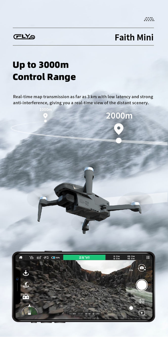
| Maximum Distance | 1080P 10km |
| Flight Time | 40mins(no Load) ,29mins(full Load) |
| Flight Control | Compatible With Mavlink Protocol Flight Control |
| Operating Temperature Range | -5-40℃ |
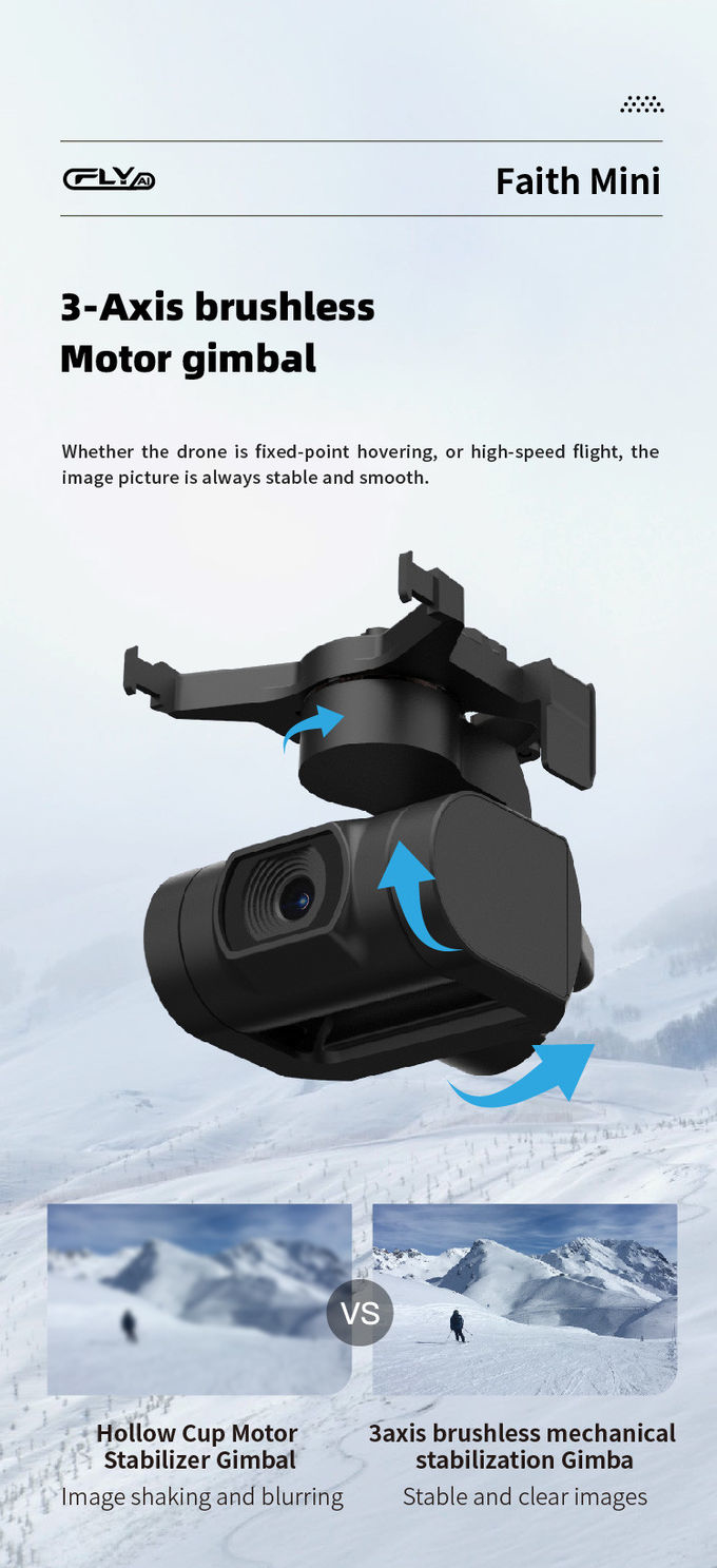
| Gimbal | 3-axis |
| Satellite Positioning Systems | GPS/GLONASS |
| Wheelbase | 600mm, foldable |
| Max Service Ceiling Above Sea Level | 5000m |
| Photo | JPEG |
| Maximum Decsend Speed | 4m/s |
| Application | Aerial-Photogrammetry-Mapping-Drones, Topographical-Mapping-Drones, Autonomous-Drone-Surveying |
Faith-Mini, a Chinese manufacturer, is proud to present the amazing Three-Dimension-Mapping-Drones. It is the perfect choice for all your High-Resolution-Surveying-Drones and Topographical-Mapping-Drones needs. With a Minimum Order Quantity of just 1 Pcs, you can get your hands on this amazing piece of equipment at a Negotiatial Price. Plus, Standard Packages ensure that you have your Drone within 3-7 Work Days. Payment terms are flexible, with L/C, D/A, D/P, T/T, and Western Union all accepted.
The amazing Three-Dimension-Mapping-Drones from Faith-Mini also come with a 2100mAh battery, which allows for a Flight Time of 40mins without any load, or 29mins with a full load. Plus, the Wheelbase of 600mm is foldable, and compatible with the Mavlink Protocol Flight Control. Photos are also provided in JPEG format, ensuring high-resolution quality. With a Supply Ability of up to 100,000 Pcs Per Month, you can rest assured that Faith-Mini can meet any of your Three-Dimension-Mapping-Drones needs.
Our topographical mapping drones, robotic mapping aircrafts and 3D mapping drones are perfect for surveying and mapping applications. Faith mini features a satellite positioning system for GPS/GLONASS, a 3-axis gimbal, image size of 3840*2160, maximum decsend speed of 4m/s and flight time of 40mins(no Load) and 29mins(full Load).


1080P 10km Remote Sensing Drones Agriculture / Crop Monitoring Drone
1 Sold

Foldable 3D Mapping Drones For Topographic Mapping 3840*2160 HK-DF8166D

4m/S 3D Mapping Drones For Surveying Land 3840*2160 Image Size

3 Axis Gimbal Drone High Performance For Fire Rescue Power Patrol HK-DF816D

Long Distance Heavy Lifting Drone Heavy Payload Drone With 29 mins Full Load Flight Time HK-DF816D

1 Sold

JPEG Photo Remote Sensing Drone 3 Axis Gimbal With Thermal Imaging Technology
2 Sold

1080p 4k Ultra HD Camera Drone Industrial Drones For Lifting HK-Faith Mini

Faith Mini 3D Mapping Drones Land Surveying Drone For Aerial Mapping
1 Sold

High Range Aerial Survey Drone 17m/s Foldable 2 Axis Gimbal Drone HK-DF809G

Custom Aerial Survey Drone Advanced Aerial Surveillance Drone For Surveying And Mapping

2100mAh 3D Mapping Drones Versatile Imaging Topographic Mapping Drone

High Capacity 5 Km Range Remote Control RC Drone With 3 Axis Gimbal Camera HK-DF816D

Aerial Photogrammetry Drone Foldable 3D Scanning Drone For Topographic Survey

Foldable Aerial Survey Drone Two Axis Gimbal Construction Site Drone Aerial Photogrammetry

Aerial 3D Mapping Drones Foldable for Land Surveying
